Mapping – Existing or New – Were here to help
Existing Mapping Products
Are you looking for an existing mapping product or a new Mapping product. Here at Northway/Photomap/Remote Sensing our staff have been creating high quality topographic maps since 1946, and have access to these maps. We also have access to a number of data sources which will allow us to provide custom or existing mapping products for most sites in Ontario. If you are looking for a mapping product, contact us today and we can give you options. Even if you want a large wall map, large aerial photo or either on a dry erase medium, we can help.
Vector Data Extraction
To facilitate digital data capture and provide digital data to a wide client base, Northway/Photomap/Remote Sensing Ltd. utilizes softcopy photogrammetry software coupled with GIS/CAD software. These systems have been developed to allow for the translation of the captured data into any specified format.
Using our softcopy stereo-plotting instruments, digital data is captured directly from the instruments into a digital file.
The vector data is represented in structured format during capture and in strict accordance with specified nomenclature or layering structure.
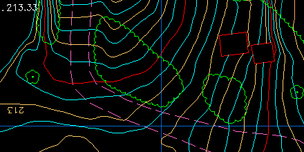
Elevation Extraction
The creation of a digital elevation model is based upon the collection of X, Y, Z coordinates which define the terrain of a mapping area. This collection of data points can then be processed for many applications dealing with surface modeling, volumetric calculations and orthorectification.
The collection of points is typically defined by mass and breakline points. The breakline information is typically captured at three times the normal density of the mass points to identify natural and cultural features, which cause a rapid change in the ground terrain. These points are, in most cases, well defined and easily readable from the photogrammetric models.
Breaklines are captured using static mode or continuous mode depending upon the feature and its required representation. Elevations are either extracted manually (read by the operator) or automatically using the automated radiometric correlation technique which provides fast, highly accuracy elevations.